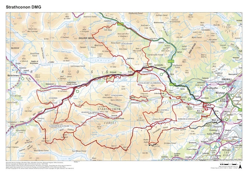
Scale and Ownership
The entire Group area extends to approximately 45,500 hectares or 112,430.50 acres.
It is bounded to the north by the A890 Lochcarron to Achnasheen road, the A832 to Gorstan and the A835 to Contin. Its eastern boundary is defined by the line of a major deer fence around the Forestry Commission woodlands at Craigdarroch and Torachilty in the north across the foot of Loch Achonachie and across Fairburn to Loch nan Eun. The fence is then continuous with that skirting the eastern and southeastern boundary of the adjacent Glenstrathfarrar Management Area .
The southern extent of Strathconon Area is likewise defined by the boundary with the Glenstrathfarrar Management Area and in effect follows the southern boundaries of Fairburn (Corriehallie) Strathconon and Glencarron (q.v). The western boundary (with the Lochalsh Group of estates) runs southwest across Meall an Fhliuchaird to Creag an Ardaich and Sgurr nan Ceannaichean, then running due south across the mouth of Gleann Uiag to the summit of Sgurr a Chaorachain.
The Strathconon DMG formerly comprised a sub-group of the larger, South Ross DMG, becoming a deer management group in its own right in 2012 following the division of the South Ross area into smaller, more manageable units.
The Group has six subscribing members with a landholding extending to approx 45,500 hectares or 112,430.50 acres. Membership includes a number of privately owned properties with varying management objectives together with publicly owned land managed by Forestry Commission Scotland. The Strathconon DMG includes from west to east; Glencarron, Ledgowan, Scardroy, Strathconon, Lochluichart, Scatwell and Fairburn.


